Tuesday, April 30, 2013

Six Foot Track Day 1: Nellies Glen, Megalong Valley, Cox's River.

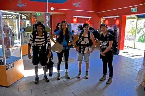
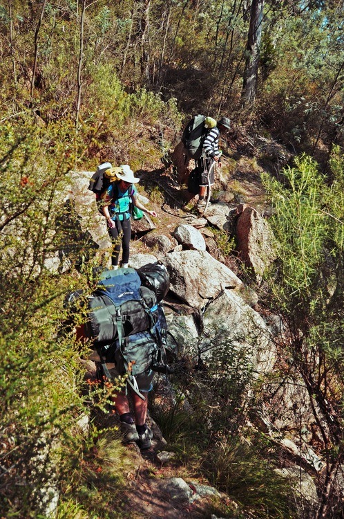
Having just done a four day practice hike through Namadgi National Park, we headed off - all “experienced” and still aching - to Katoomba to start the Real Thing: the Six Foot Track.


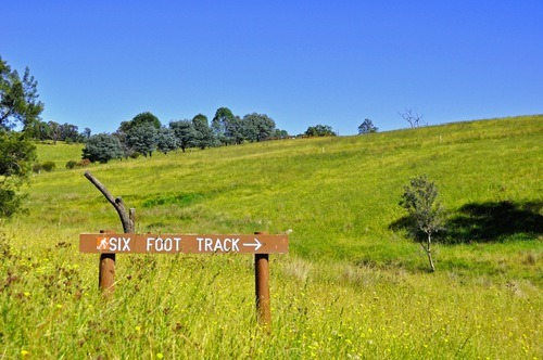
The Six Foot Track, which runs for 45kms from Katoomba to the Jenolan Caves, was originally built as a horse trail in the 1880s to allow better tourist access to the caves. 


These days, it’s the route of a famous marathon here in Oz, a popular bushwalking trail through the Blue Mountains, and a common training ground for the crazies preparing to hike the Kokoda Trail.


Although typically done over three days, the Duke of Ed program requires us to go on a four day adventurous journey, so we averaged out the hike over four days and three nights, leaving ourselves some time on the last day to explore the caves. 


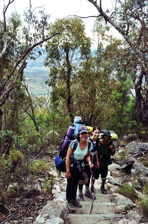
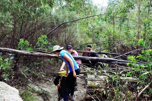
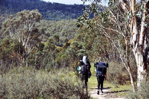
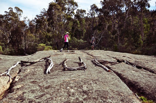
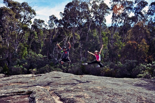
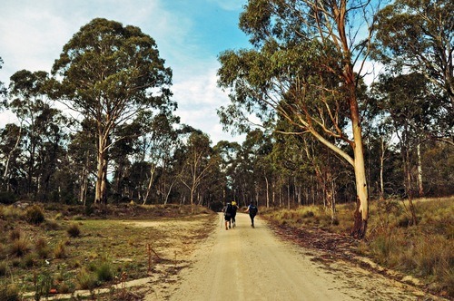
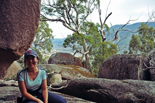
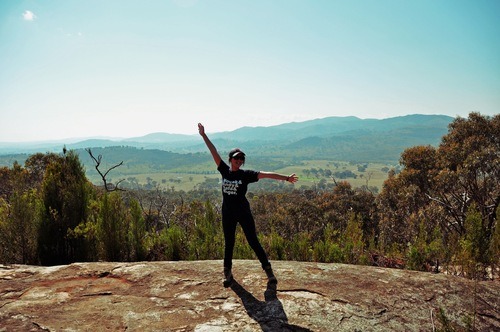
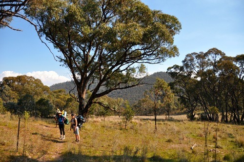
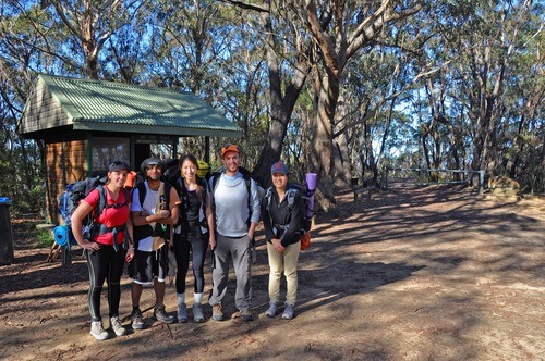
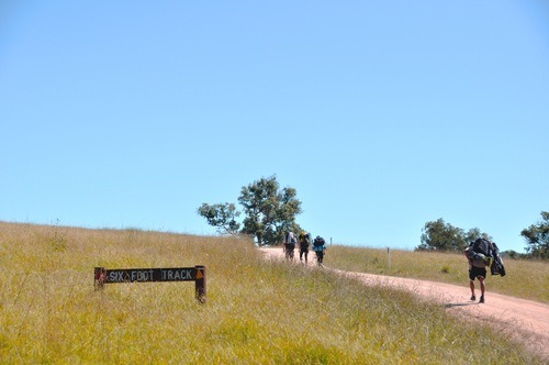
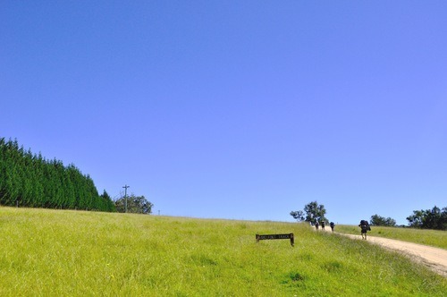
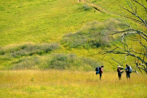
And so we were off, bright and early on an Aussie autumn day. The photo below was taken at the start of the track by an elderly couple, who became our trail buddies for the rest of the trip. They were both from the Blue Mountains area and told us some stories about the history of the trail. 


image


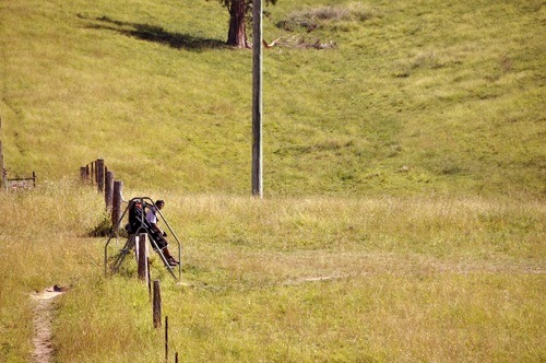
From the start of the trail, we immediately descended steeply down the cliffs of Nellies Glen. Straightaway it became difficult, as we thudded down the steep, slippery stairs, trying not to lose our balance or roll an ankle, which I eventually did anyway. By the time we emerged out of the lower sections of Nellies Glen, my knees felt like jelly and my right ankle throbbed ominously. We took a quick break to tape up my ankles and eat some trail mix before setting off again - thankfully this time along a more level part of the trail towards Megalong Village. 


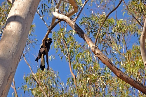
Along the way, we stopped to admire a flock of six yellow-tailed black cockatoos who were silently gliding around among the gum trees, watching us from above without a hint of alarm. They were simply magnificent. 


image


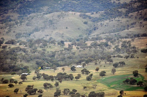
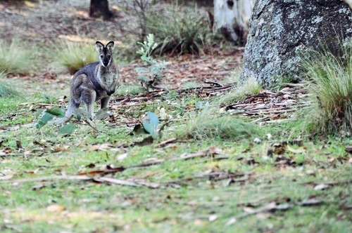
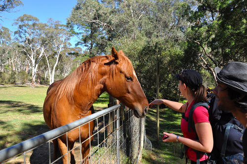
And as we trekked through the settled parts of Megalong, we came across farms where horses and kangaroos lived side-by-side, one domesticated and the other wild. 


image


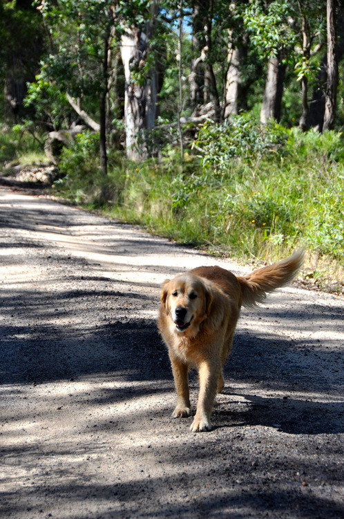
Two puppies from a nearby farm also came out to welcome us, and trotted after us for a while until we hiked further and further from the vicinity of their home. 


image


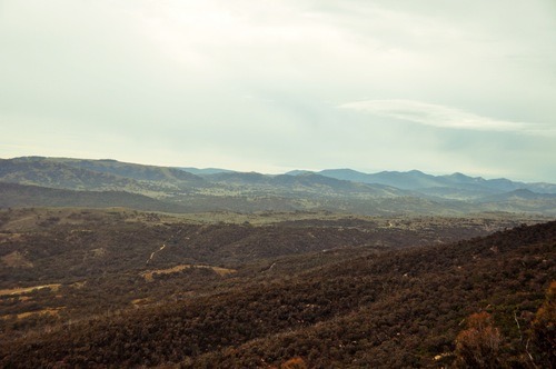
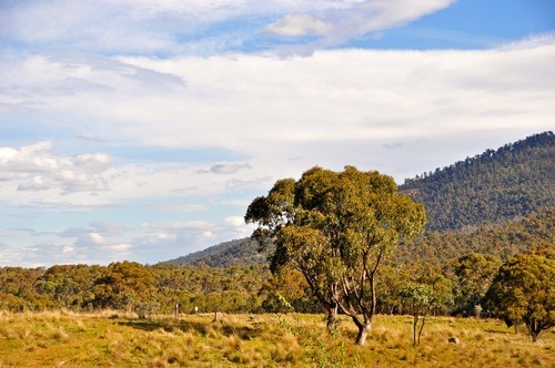
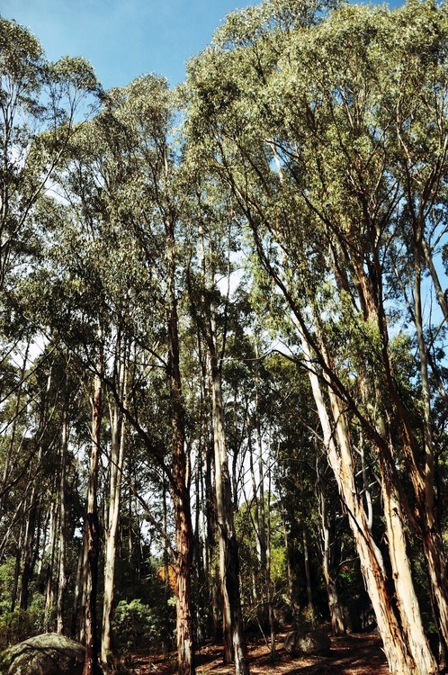
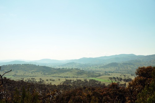
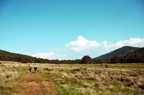
And soon, it felt like we were hiking further from the vicinity of anywhere. The trees grew sparse, signs of humanity faded into the margins of our vision. It was nearing noon, and there was no shade to be found. 


image


image


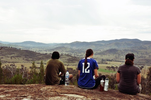
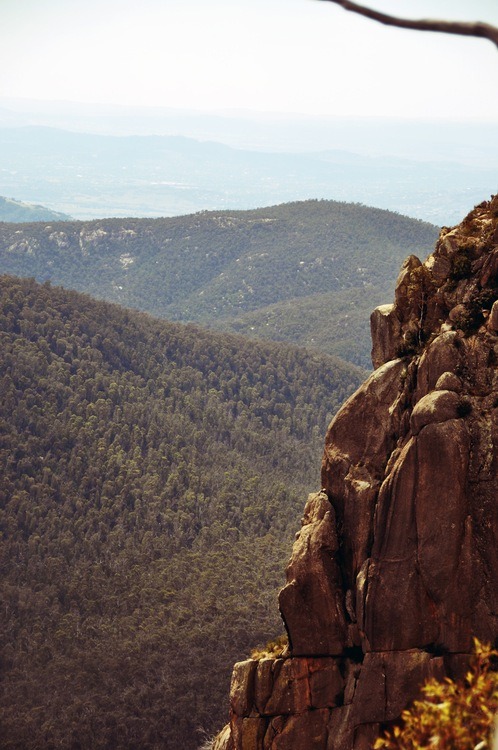
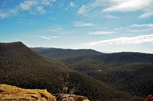
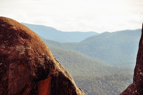
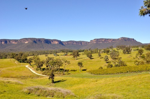
I was beginning to wilt a little in the sun, annoyed by the sudden lack of cool shade when I just happened to look back and see where we had come from: 


image


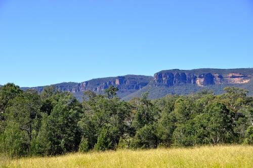
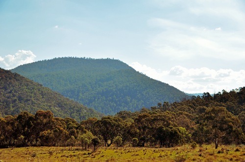
The views were simply incredible. Mountain cliffs behind us, grass lands and rolling hills ahead. Somewhere along the way, we walked past a fox, curled up sleeping in the grass. It eyed us lazily, and like all the other animals we came across on the hike, it didn’t seem to feel remotely threatened by our existence. We were in its home after all.


image


image


image


image


image


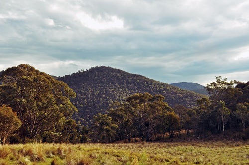
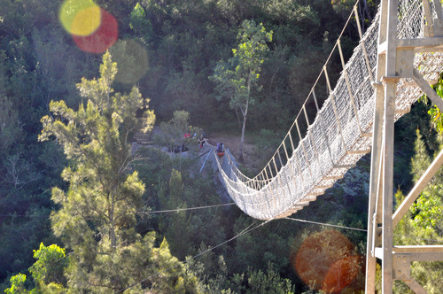
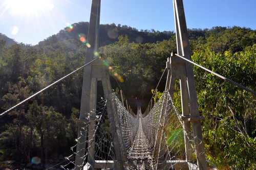
Soon after we left the grassy hills of Megalong, the scenery changed again. This time we were walking along a relatively narrow track on the side of the mountain, until we came to the highlight of our day: the Bowtells Swing Bridge - one of the longest suspension bridges I’ve ever seen. It allowed only one person on at a time and swung ominously over the rocky Cox’s River. It took us a good half an hour to cross the bridge individual, as we shouted words of encouragement at each other and laughed when the bridge shook as each person reached the middle section. 


image


image


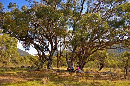
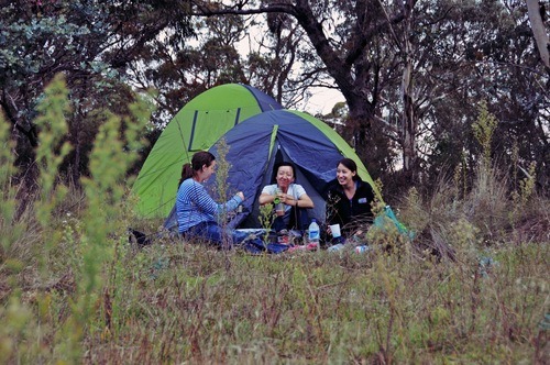
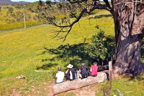
Soon after the bridge, we reached our camp site for the day. The elderly couple who had started out with us had put us to shame by reaching the campsite way before us. They chose to wade across the river rather than go on the suspension bridge. Together we sat in the afternoon sun and talked about our work, our lives and the previous hikes that we’ve done. 


They told us how happy they were to see young people like ourselves out there in the bush, challenging ourselves. I gave a mental hair flick, even as I swore to myself I’d never do this again. 


By 5:30PM, it was almost too dark to do anything. And so we crawled into our tents for our longest, coldest night in the bush yet. 


xx doots

Saturday, April 20, 2013

Namadgi Hike Day 4: Back to the beginning

We woke up on Day 4 thinking of long showers, coca cola,  the latest Game of Thrones episode and all the comforts of hunan civilisation. By 8:15am, we were off, eagerly powering through Mount Tennent, drawn towards the direction of home as if pulled by some magnetic force. 


To our home surprise, we ended up back at the Namadgi Visitors Centre by noon. And on queue as we stepped under a roof for the first time in 4 days, it started to rain.


We whooped at our good fortune, and congratulated ourselves on not killing each other in the past four days. 


Inside the visitors centre, we recounted our tales of adventure and exhaustion to the park ranger who had helped us in the planning of this trip. Somewhat distractingly, Marianne - the resident pet python of the Namadgi Visitors' Centre - was shamelessly stripping off her skin while we chatted. What a hussy, that one!


This trip has been the most physically exhausting 4 days of my life, but despite the exhaustion, I’ve learned so much about the region of Canberra we live in, about myself and my own physical limits.


Walking from Point A to B is one of the most fundamental human drives. We’ve been doing this on a day to day basis from the beginning of time. But hiking, particularly through mountainous terrain, has a funny way of challenging the things in life we take for granted.


Just when you think you’ve finally reached your limits, just when you convince yourself that you are simply not capable of taking another step forward, you look up around the bend at a view that takes your breath away and makes you forget about all your physical pain. 


I can’t say I’ll ever find this enjoyable, or do it on a regular basis, but I do find myself understanding why people hike voluntarily. There is something both humbling oddly life-affirming about putting yourself so directly through a landscape and depending on yourself so utterly for survival. 


And so it’s back to work for another week before we set off on our second hike for the Duke of Ed Awards. This time, we’re doing the Six Foot Track through the Blue Mountains, and the real adventure is just about to begin. 


xx doots


Friday, April 19, 2013

Namadgi Hike Day 3: Honeysuckle to Bushfold

Day 3 was the beginning of the end in a way, as we were starting the two day hike back to our starting point where our cars (civilisation!) were parked. And it was off to a good start with an early morning visit from Mr Wallaby! 


image


We set off from Honeysuckle at around 10am, and hiked the 5km back to the spot where we camped on our first night, near Booroomba Rocks.


Although we were in this area just two days ago, we never climbed up to the Booroomba Rocks because of timing and our lack of water at the time, so we decided to check out the rocks on our way back. 


The hike up to Booroomba was only 2.4kms, but it was easiest the steepest 2.4kms of our entire trip. Thankfully, we made the climb without our packs on, but even so, I was puffing like a steam train by the time I made it to the top of the rocks. 


But as I was quickly learning, the tougher the climb, the more rewarding the views. 


image


I made it, ma! I’m on top of the world!


image


After Booroomba Rocks, we had a lunch of mountain bread and Laughing Cow cheese, before continuing on our merry way through the gum tree forrest we hiked on Day 1, back to Bushfold Flat where we planned to camp for the night. 


The track was well-trodden by local mountain runners, but not without a fair amount of obstacles … 


image


Maybe we were getting fitter, maybe we were getting less lazy, but the way back never seemed to last quite as long as the way there. Before long, we found the trees clearing up and the path levelling off, we had made it to the foot of the hills. 


image


Rather pleased with our progress, we found ourselves a large tree, and had some trail mix of champions: almonds, walnuts, sultanas and soy crisps. There may or may not have been gummy lollies involved too. 


image


image


Gorgeous afternoon sunlight over the Flat.


image


(Fun fact of the day: before Namadgi became a national park, some early settlers had tried to make a life here. They gave up eventually because of the remotedness of this area pre-Canberra, but you could see pastoral relics everywhere - settlers’ huts, homesteads, and of course, old fences like this one.) 


image


With the setting sun casting a golden haze over Bushfold Flat, we decided to continue on until we found some suitably flat ground to set up camp for the night. 


You would think a place called Bushfold flat would be full of - ohidunno - FLAT GROUND, wouldn’t you?


Wouldn’t you?! 


Apparently we did, but it was not so.


As soon as we started looking for flat terrain to camp on, there seemed to be inclines everywhere. It took us another hour and a half to pick a camping spot.


By the time we set up tents, we were so exhausted that we didn’t even notice that our camping spot appeared to be in the middle of the Animal Highway of Shit.


Our tents were literally surrounded by poop, on top of poop. Every step we took, every piece of ground we stood on, sat on, pegged our tent into, was covered in pellets of kangaroo shit. 


“Well … at least it’s kangaroo shit. I mean … they only eat grass,” my fellow hikers reasoned. 


That’s cold comfort. A vegetarian diet hardly makes shit any less shitty. 


But we were too poopedourselves to move the tents again. Instead, we heated up some water over our tiny camp stove, made ourselves hot chocolate out of sachets, and watched the sunset over Bushfold Flat.


Somewhere far away, wild dogs were howling. 


Funny thing about camping - it turns the things you never even eat in everyday life into rare luxuries. Because sitting there, watching yet another glorious sunset, and nursing my aching feet, I don’t think I’ve ever had a better hot chocolate in my life. 


image


image


Wednesday, April 17, 2013

Namadgi Hike Day 2: Honeysuckle and Legoland

Day 2 began after what seemed to be the longest night ever. We all slept restlessly, drifting in and out of fits of dreams all night. 


I was first up the next morning at 6:30am, and unzipped my tent just in time to see a mountain runner jog past like it was the easiest thing in the world. We bid each other g'day as he continued on, muscular and glistening in the morning sun, and I crawled slowly towards the nearby compost toilet (read: gaping hole full of shit). 


Urgh. 


Gradually, everyone got up, ate a quick breakfast of mush, and continued on. About 20 minutes into our Day 2 hike, we came to a rocky clearing where someone had evidently gathered a lot of twigs and spelt out “HI MUM!” with them. 


image


image


Being the hilaaaaarious people that we are, we instantly named this rock “Hymen Rock”, and proceeded to show off our astounding level maturity by doing star jumps all over Hymen Rock. 


image


image


Having expended a lot needless energy jumping around, we soldiered on into the bush, occasionally stopping to admire the native flora and fauna in the area - gum trees, banksias, wallabies Eastern Grey kangaroos, who jumped onto our track a few times, looking alarmed at the intruders in its ‘hood. 


image


image


About 1.5 hrs later, we arrived at our designated campsite of the day - Honeysuckle Creek, where we were finally able to fill up some water from the rain water tanks. 


Fun fact I found out about Honeysuckle Creek only after the hike: it was a former NASA tracking station who provided the world with the first pictures of the Apollo 11 moonwalk! 


image


While we cannot claim to be taking giant footsteps for mankind ourselves, we did decide if that we wanted this to be a proper hike, we probably needed to walk for more than half a day.


So we set up tents for the day, had a quick lunch, repacked our bags full of water, food and weighty objects, and set off for a practice hike towards a rocky, steep area nearby full of large boulders, known colloquially as “Legoland”. 


The return trip, which was about 10KMs in total, was probably the hardest hike of our entire trip. The road started off deceivingly easy - it was well maintained enough for the ocasional car to drive past, and at least initially level.


But before long, it became evident why people drive, and not hike, to Legoland. Bend after bend, our track morphed into a relentless, steep incline along Orroral Ridge. 


I soon found myself lagging behind, wanting to give up, but peer pressured to keep walking. After about an hour and a half of breathless crawl, we came upon a group of day hikers on their way down from the top of the ridge. 


“You’re almost there! I’d say about 15 minutes.” They told us. 


“THAT’S WHAT THE GUY YESTERDAY SAID.” I sobbed through a waterfall of snot, sweat and tears. 


They cracked up laughing. “I promise. 5 minutes if you race yourselves.”


Race ourselves? Over this fucking terrain with our 40L packs? I think not. 


image


But lie they did not. About 20 minutes later, we made it to the top of Orroral Ridge to an area marked simply as “Large Boulders” on our map.


Thankfully, local rock climbers have devised slightly more creative names for this area: Legoland, the Cloisters, the Tower … all attempts at describing these large - impossibly large - rocks perched at the top of the mountain, forming a cliff face sorts that look out into the valley.


They were remarkable, and would’ve been a tourist attraction worthy of its own ice-cream stand in any other country. Incredibly, only a few rock-climbers seem to know about this area at all.


We met one such rock climber, who kindly showed us a way of squeezing through the rocks, lying on our stomaches, and rolling out from underneath a bunch of rocks that would’ve blocked our panoramic views. 


image


image


We followed his advice and came out the other side of a pile of boulders to find ourselves sitting on the outside rim of the rocks, with the most spectacular view of the Canberra region. 


image


image


The afternoon sun was setting by then. We needed to rush back to the campsite so that we may have a bit of daylight left for cooking and chores.


But for 25 minutes we lingered, and for 25 minutes, it felt like we had been let onto a secret no one else knew. 


xx doots

Monday, April 15, 2013

Namadgi Hike Day 1: Mt Tennent to Booroomba Rocks Car Park

A week before I left on the hike, every one of my colleagues was taking the piss out of me. 


“You know you can’t wear heels, right?" 


"Don’t forget to take your mascara!" 


Yes. Me. The person who owns precisely one pair of pants and one pair of flats (for emergencies) in a wardrobe full of dresses and heels now has to wear hiking boots, Kathmandu and Macpac branded gear and venture into the great unknown commonly referred to as The Bush


Holy. Shit. 


But for some inexplicable reason, I had gotten myself signed up to the Duke of Edinburgh Awards, which have to be completed before the age of 25. And as I approach the age of quarter-century crisis, it’s time to complete the most daunting task of the DOE Awards - the 4 day "adventurous journey” into the middle of fucking nowhere. 


Our assignment: to complete a practice journey, followed by the actual qualifying journey.


Our destinations: Namadgi National Park just south of Canberra for the practice journey, and the Six Foot Track in the Blue Mountains for the qualifying. 


So it’s off to the Namadgi Visitors Centre early Friday morning for the start of our ADVENTURE. 


image


All bright and chirpy. Little did we know …


The morning started off promising enough. We began by hiking up Mount Tennent. The day was clear. The views were stunning. The terrain was friendly … 


Until it wasn’t.


Half way up Mt Tennent, the terrain got steep. Our packs full of 4 days’ worth of clothes, food, water, sleeping bag and toiletries weighed like a baby elephant on our backs. Every step became a struggle. Every breath a desperate gasp. And every now and then, a day hiker would jog past casually, wearing the latest Gore-Tex gear, carrying nothing but a bottle of water and their hiking poles, and bid us all “g'day” like it was just a nice stroll in the woods. I wanted to smash them in the face with my baby elephant.  


image


image


The hills are aliiiiiiive ….


image


image


About 2.5 hours later, with my breathing reaching panic attack levels of hysteria, I finally crawled like a tortoise to the Mount Tennent junction, where we had a lunch of vegetarian burritos (om nom nom), before descending a meandering track down the shoulder of Mount Tennent. Before long, we had reached a beautiful area of Namadgi known as the Bushfold Flats, which - as the name suggests - was flat, grassy, and wedged between mountains on either side.


The scenery was superb, and we felt like the only people in this special corner of the country. 


image image image


image


But Bushfold Flats had lulled us into a false sense of security, especially when it came to a rather abrupt end, and we found ourselves walking through a rather dense gumtree forrest uphill. And uphill. And uphill. And uphill … it seemed like every time we turned and expected the landscape to plateau, we found another upward incline. I was struggling by then. No longer capable of walking like a respectable human being, I was stumbling through the bush like a zombie with a swag - flailing, panting, cursing at the sky for my own foolishness in agreeing to do this. 


Suddenly, around yet another uphill bend, we heard footsteps. Out of the bush emerged a man I’m not entirely sure wasn’t a hallucination. He was shirtless and wearing what could only be called a skirt. He had a beer belly that hung as low as his knees, and when he spoke, he spoke in the unmistakable accent of a Kiwi. 


“The car park? Oh you’re not far awrff,” he said, referring to the next landmark we were to look for on our hike, “maybe about fef-teen minutes?” 


15 minutes my eye.


30 minutes later, the sun was setting, the temperatures were dropping, and we were still stumbling through the bush while carrying the weight of worldly misery on our backs. 


“I’m sure it’s just around the corner, guys. Not far now!” said fellow hiker Lauren. I wanted to punch her in the face. Then punch everyone else in the face. Then punch myself in the face.  


But failing to do any of that, I did the next most sensible thing: I put one foot in front of the other and took just one more step. And then another. And then another. 


We never made it to our intended campsite for the night and ended up camping in a clearing near the Booroomba Rocks. On our first day, we hiked just over 13KMs through varied terrain. To top the day off, the canister of gas I was carrying was punctured and leaked. All of my clothes  smelled like gas. Not baked beans gas. Poisonous suicidal gas. Which was probably a close reflection of my mood by that stage. 


At 6:30PM, when darkness finally settled in for the night, we all crawled into our tents, too exhausted to watch the stars, or eat marshmallows, or make an attempt at ghost stories, or do any of the cheesy things cheesy people do at cheesy camps. Too exhausted in fact, to be bothered by the scuttling outside our tents all night from unknown creatures. 


This was going to be the longest fucking night ever. 


xx doots